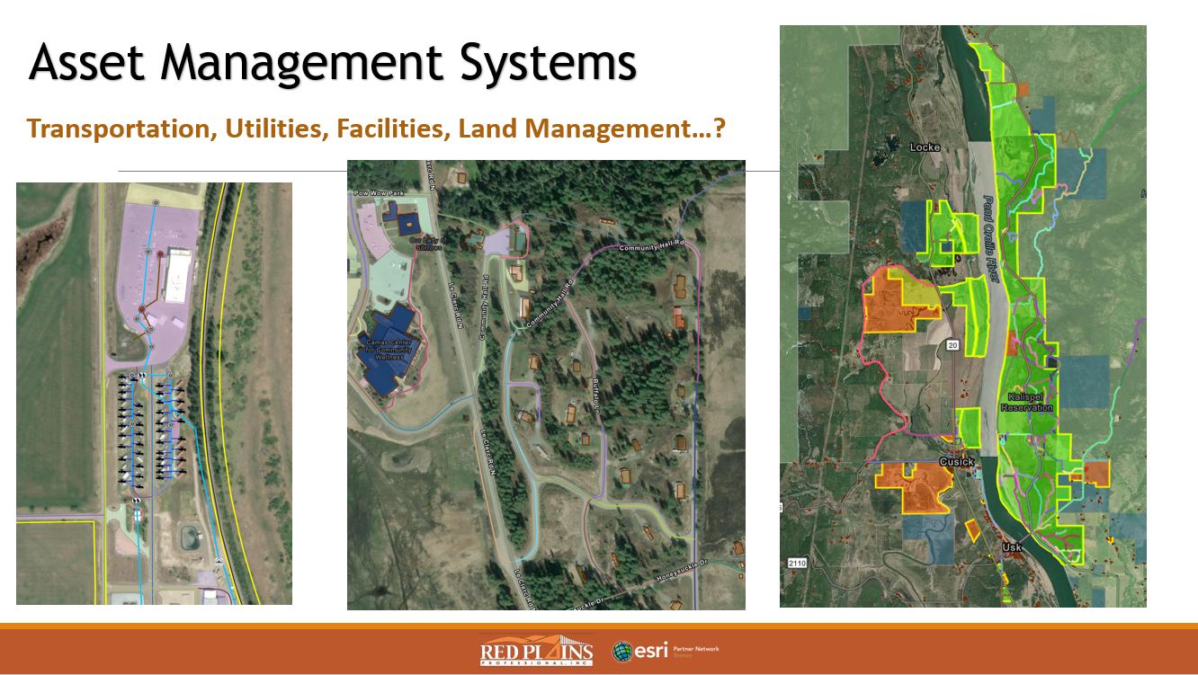
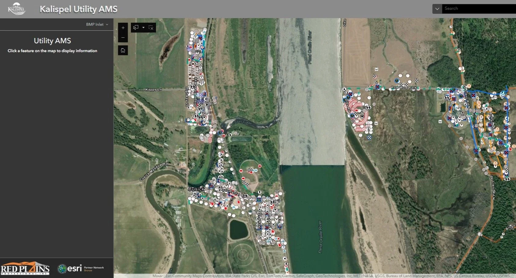
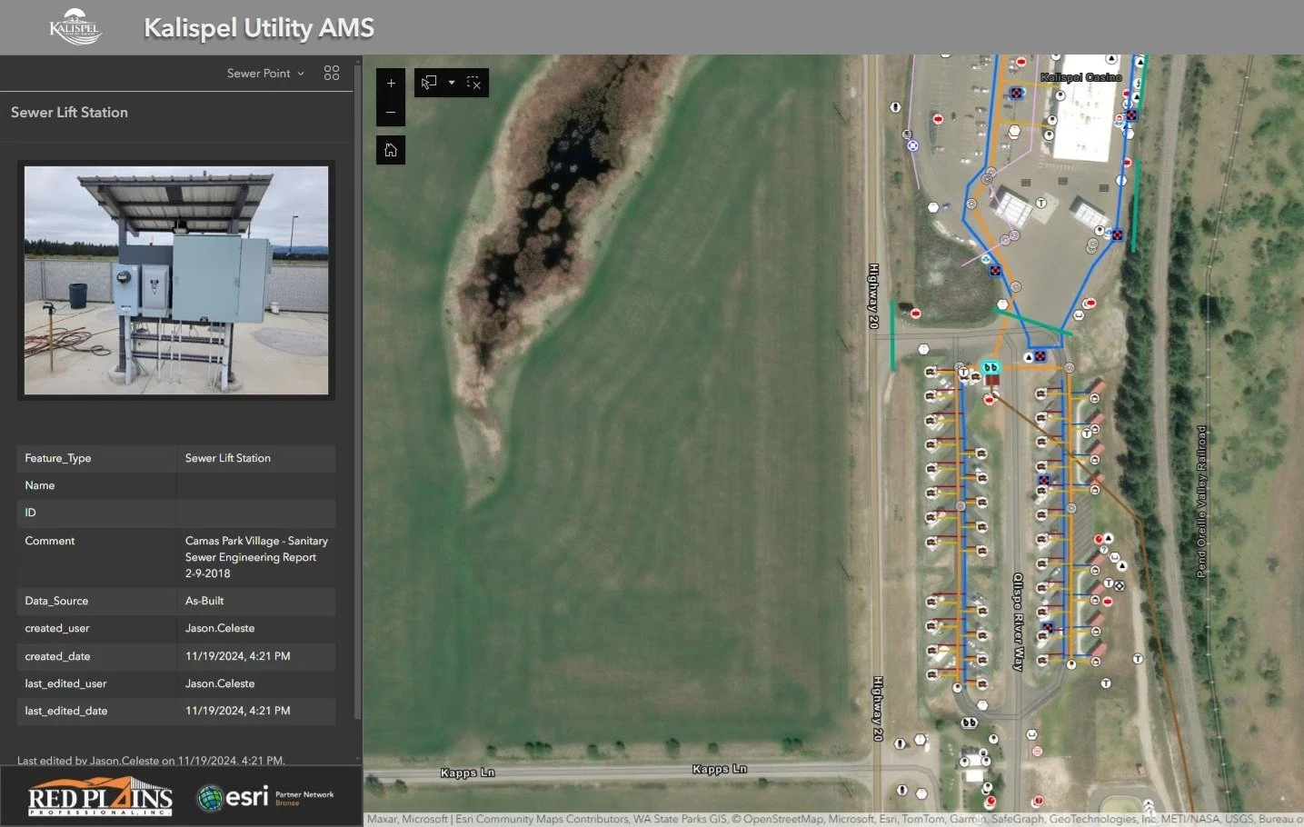
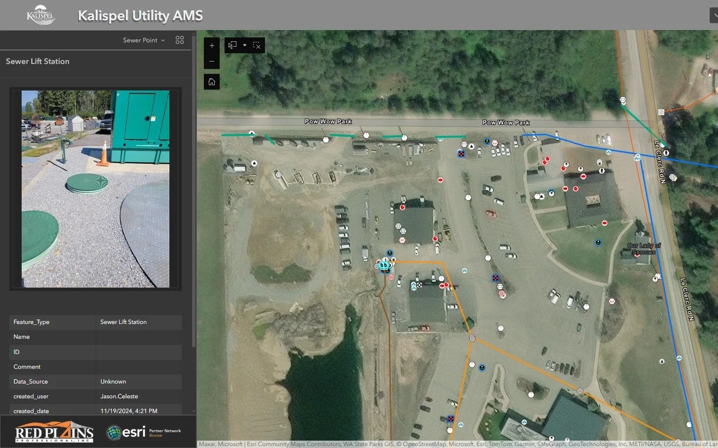
GIS Asset Management System (ASM Development), Kalispel Tribe, WA
Our GIS professionals collaborated with the Kalispel Tribe’s Planning, Transportation, Public Works, Maintenance, and Economic Development teams to create a comprehensive map of the Tribe’s transportation and utility infrastructure. This project covered the reservation lands near Usk, WA, and the Airway Heights development. We digitized extensive paper records and designs, conducted high-accuracy field data collection, and consolidated the datasets within a GIS. The Tribe now has a dependable GIS that preserves decades of knowledge and reflects current field conditions in a dynamic mapping system. User-friendly ESRI web applications enhance planning and maintenance with a reliable foundational map. Additionally, the GIS integrates with the Tribe’s Maintenance Management System, “iWorks,” becoming an interactive digital archive between the historical plan sets/as-builts and the real time conditions.